Kosta solo exhibition at Hilbert Museum - March 22-August 9, 25. Learn More
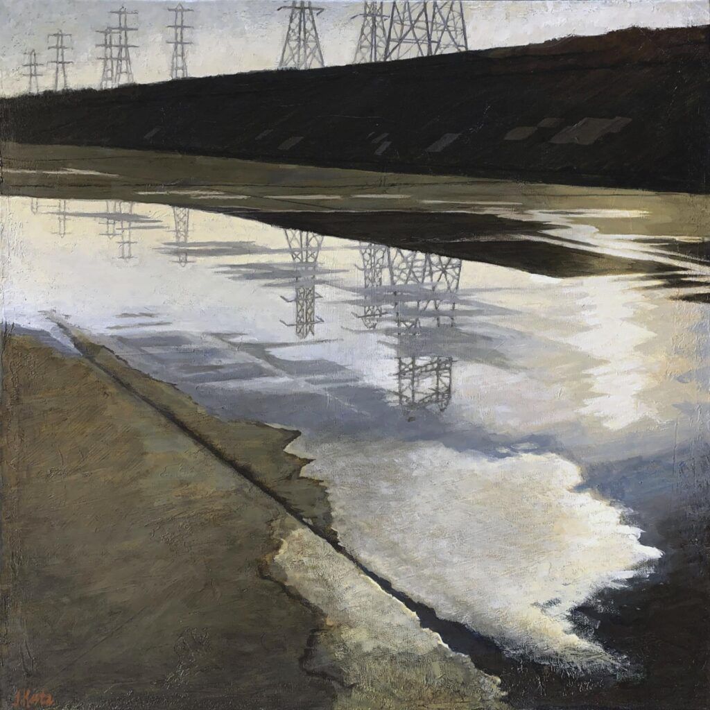
LOS ANGELES RIVER SERIES #9
Los Angeles River #9
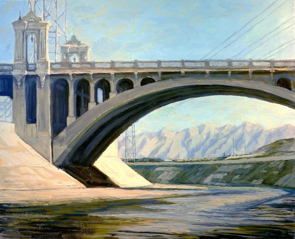
Good Morning San Gabriels
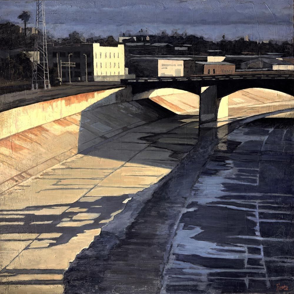
Downtown Los Angeles
Oil on Canvas 24" x 30” x 1.5"
Los Angeles River Series #9
(2019)
The San Gabriel, Santa Monica, and Santa Susana Mountains border the eastern boundary of the Los Angeles River watershed north of the city center. Many who visit southern California for the first time are surprised by the region’s mountains and hills. And while southern California generally earns its arid reputation, when winter rains arrive, they are sometimes torrential. In the late 1800’s and early 1900’s the Los Angeles River flooded numerous times causing significant property damage: This spurred the US Army Corps of Engineers, with the support of the city of Los Angeles, to channelize the river all along its entire 51-mile length.
For those lucky enough to arrive in downtown Los Angeles from the eastern suburbs via early morning train, this bucolic view, as depicted in Los Angeles River Painting 9 showing the San Gabriel Mountains to the north, greets one moments before arriving at Union Station. Here the mountains meet city and the sun casts pink highlights along distant ridges of purple mountains. Concrete riverbanks and ever-present electrical towers identify the scene as distinctly Los Angeles.
If you are interested in this painting, you can view more details in the
Store. If you would like to learn more about the City of Los Angeles' River Project, explore the links below.
More on the Los Angeles Revitalization Project
An interactive map that highlights a number of the developments planned and occurring along the Los Angeles River.
Home of the Los Angles River Project, an organization dedicated to restoring the vital ecosystem along the river.