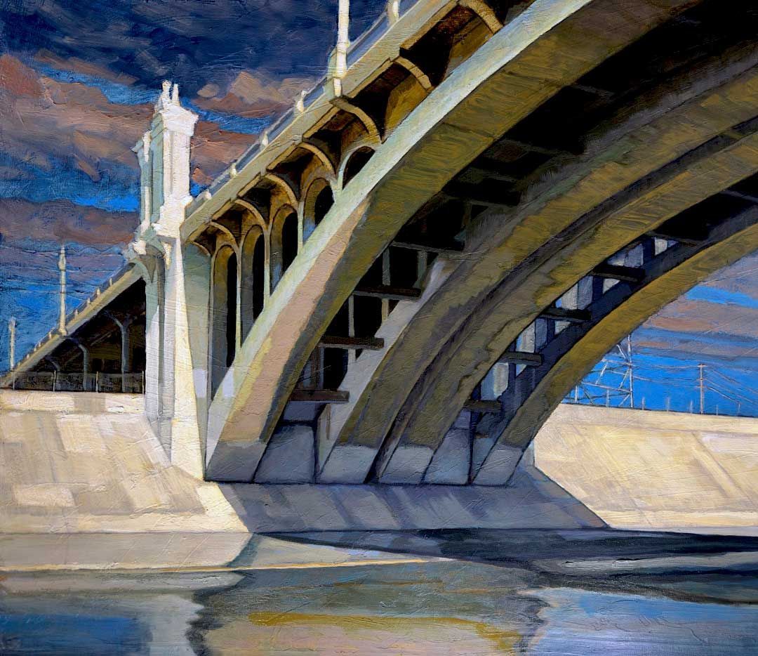
LOS ANGELES RIVER SERIES #25
Los Angeles River Series #25
Arroyo Calabassas Drainage Channel
Bouganvilla and Shoup Street Bridge
Acrylic on Canvas 24”x 30”x 1.5”
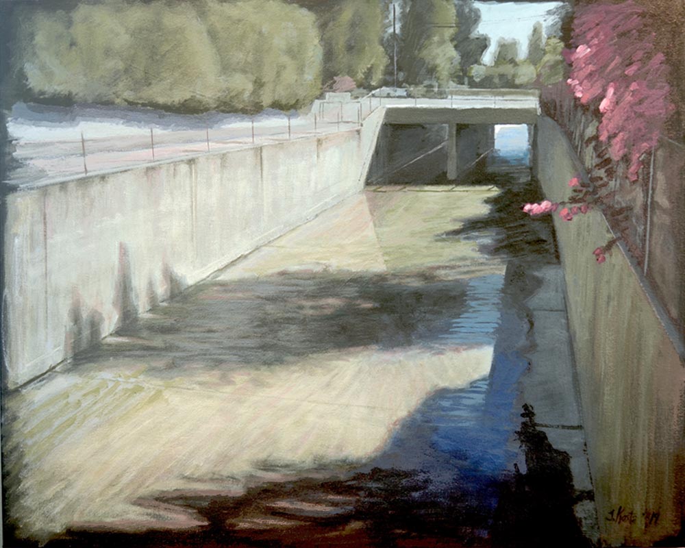
Los Angeles River Series #25
(2020)
Within the San Fernando Valley, most local residents would call the Arroyo Calabassas Creek a drainage channel, even though it is actually the most western headwater tributary of the Los Angeles River. As is currently the case with most Los Angeles River tributaries, the Arroyo Calabassas Creek has limited public access, blocked by chain link fences and no trespassing signs. Passing through numerous neighborhoods and suburban developments, the creek is an ideal place for adjoining bike paths and walking trails. The political will to increase access to the river and its tributaries seems to be growing with the development of The Upper Los Angles River Tributaries Plan (ULART) which envisions connecting almost 1,000 miles of trails and greenways along the river to provide direct walkable access to over 1.5 million Angelinos.
This 25th painting in the Los Angeles River series depicts the Shoup Street Bridge located approximately 1/4 mile west of where the Los Angeles River begins in Canoga Park. Neighborhood irrigation and street runoff provide a steady supply of moisture enabling the growth of channel-moss and algae. A nearby tree casts a large diagonal shadow of blue, dark green and gray reflecting the silvery cerulean blue light of a typical Southern California day. Catching bits of sunlight, the magenta flowers of a tropical Bouganvilla vine poke through a chain link fence. They are nature’s minions, fingers of life and color invading the boundary of man’s Engineered River.
If you are interested in this painting, you can view more details in the
Store. If you would like to learn more about the City of Los Angeles' River Project, explore the links below.
More on the Los Angeles Revitalization Project
An interactive map that highlights a number of the developments planned and occurring along the Los Angeles River.
Home of the Los Angles River Project, an organization dedicated to restoring the vital ecosystem along the river.